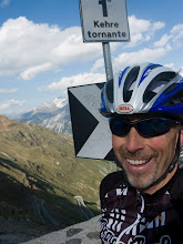
Firsts / Highlights - Train-assisted route, San Gimignano, Volterra and descending 18% cobblestones through medieval streets of Colle di Val d’Elsa
Miles Ridden - 62.57 miles (+3 or 4. Forgot to start GPS when I got off the train in Poggibonsi)
Vertical Feet - 6,322 ft
Route - View Today's Route Here.
People - Just me
This post is from May 27, 2009.

I attempted a new technique today. I rode The Machine from the hotel to the train station and took the train for ½ hour to a town called Paggibonsi north of here. This accomplished 4 things. 1) It allowed me to reach some towns that would have been a real stretch if I had done them from the hotel, 2) big sections of the ride would have been out-and-back if I had left from the hotel, 3) being “out there” committed me to my ride (if I didn’t make it back to Siena, I would have none of the comforts of home and have to pay double rent for a second hotel – I made it back at 7:30), and 4) purely by coincidence, the train’s part of the journey was into a headwind, so I had a tailwind for a little more than half of the ride.
 Tomorrow, I am going to attempt the ever-perilous double train-assist route. I will take one train to my start location, ride my route and catch a train at another location back to Siena. There are plenty of things that could go wrong with the plan, but I am leaving enough time that I should be able to spend time in the towns along the way and still catch the train. If I miss it, it’s going to be a hard ride back to Siena before dark (or an unplanned hotel with stinky clothes).
The GPS has been nearly a necessity for all of my self-navigated rides, but for the train-assisted route, it worked beautifully. First, the GPS lets me know when to get off the train if I can’t see a station name. I have used that feature a number of times. More importantly, it found a route out of Paggibonsi so I could find the roads I planned for my route. Then, of course, there is the usual benefit of having it beep at me for every turn and traffic circle throughout the day to let you know where to go. I carry a map as a backup, but I almost never need to use it. Everyone who has used a GPS knows that they are not yet perfect, but I would not want to be without it on this trip. The level of detail it has in its maps for all of the tiny little roads throughout Europe is impressive.

Today’s route visited 2 of the medieval hill towns that were on my “possible destinations” map before leaving the U.S. - San Gimignano and Volterra. You can see Wikipedia descriptions of the towns with the links in the “Highlights” section above if you are interested.
 If you find yourself in Siena with a bicycle (or and Italian or German sports car), go to my GPS route and do the last 20 miles of today's ride. It is like a cycling test track. A tough climb followed by a long descent with curves, perfect pavement, forest, shade and no traffic. A good way to finish the ride.
I have been hesitant to say anything about the weather, but after a full month with nothing but clear days, I suppose I have to risk the jinx and say it has been great. Apply whatever superstitions you like, but please keep the good weather coming. I can't assume it will stay this good throughout my stay, but I'll take it while I can get it. As I am writing, the wind just kicked up dramatically. That didn't take long. This town has been around for a lot of years, but it sounds like it is about to blow away. Shutters are slamming around town and roofs are clattering. I guess I shouldn’t worry about it. I’m sure Siena has seen a wind gust before.


No comments:
Post a Comment